Glad the master cylinder rebuild came out OK, Paul. The ones on the old vehicles I usually work on almost always have to be replaced or sleeved due to pitted bores. Is the brake fluid used in airplanes superior or special than what us mere mortals use in our cars, trucks, and motorcycles? And BTW, what kind of paint are you using on the speaker cabinet? Maybe an epoxy to withstand all the rough handling?
When I was splitting oak a couple days ago, Kyle, I came across one piece that was rotten inside and held a large grub of some sort that had chewed it's way quite far into the healthy wood. The hole it left behind was almost a quarter inch across, much bigger than any carpenter ant I've seen would leave. No idea what it was, but I sure hope it's not doing the same in standing trees.

They say "it's always darkest before the dawn", and it seems like that's pretty much where we're headed, at least from a medical and political standpoint. Not a good place to be, but then that' life thee days, isn't it?
Trans disassembly went smoothly yesterday, but the shaft that needs the circlip groove turned out to be harder than the cutter bit, so there will be something of a delay while I find one that will work. The lathe I bought back in 2010 during the Great Recession came with a large number of cutters from the ThinBit company, but they're all made from high speed steel. I'm hoping they're still in business, and also have carbide offerings. But I was able to get the shaft chucked in the lathe, and get the cutter I had properly positioned without having to remove the adjacent gear, so that's a very strong sign I'll be successful if the correct bit can be located. I also need to do some more homework to determine the correct depth for the groove, as the one account I've read had it deep enough that the circlip I have would be rattling around on the shaft.:confused2: But it was nice to see an old friend in person for a change, instead of imagining what they look like while chatting on the phone or composing a text message.
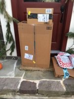
Another package held a fancy new jacket from Klim, a name I don't know how to pronounce but that has emerged as something of a leader among so called "adventure" clothing in the past few years. I didn't order it, instead it was an honorarium from my motorcycle club as a thank you for the years I spent helping out with their web site. I'd been contacted by one of the directors, who asked my size, and who was told I didn't need or want a new jacket. But there it was anyway, and two sizes too big, with a club patch and my name embroidered across the chest. Oh well, it can keep company in the closet with similar sweat shirts and jackets from another club I used to belong to...:confused2: