GPS Discussion Group

   / GPS Discussion Group #11  
I hate to bash, but I really dislike the delorme products. I've returned everyone I've bought, and I think I've bought them all.

There are 6 or so different products, they all work differently, and all have different feature sets, but they are not sub sets and supersets of features, and the products don't work together and cannot (or are severly limited in their ability) to interchange data. I could not find an combination of their products (let alone a single product) that would let me do what I wanted, which I thought was pretty simple and reasonable.

I wanted to be able to view a topo map, draw a set of property boundried on the map, download it to my palm pilot, then go in the field and navigate the property lot with the palm pilot and their GPS, and trace roads and trails. On return, I wanted to merge the trace data into the drawing of the property bounds so I could over time accumulate an increasingly detailed map of the property with roads, trails, etc. I didn't think it was asking too much and seemed to me to be a common use for their topo maps, GPS, and palm pilot software. After 3 years of different updrages, new products, new versions, I gave up.

OK, I feel better now.
 
   / GPS Discussion Group #12  
I use Garmins MapSource with my III+. I've not saved any tracks, but I know it's possible.
 
   / GPS Discussion Group #13  
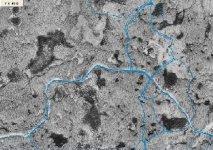
I have the Vista and I use it for 4 wheelin(Polaris Sportsman 500 HO). I upgrated to expert GPS from easy. Download the free demo for awhile. The airiel photos make your tracks make sense. Because it is internet based you do not buy any topo maps. If you have an ATV join ATV NATION the forum for atvers that actually sent me to tractorbuynet.
If you were to visit I could send you tracks to follow of my trails ExpertGPS is a worthwhile upgrade. I have no monetery interest in the co BTW.
 
   / GPS Discussion Group #14  
Here's a great collection of reviews and information on everything to do with GPS.

I once read about a neat software/GPS/tractor product. The idea is that you want to spread fertilizer when the sun is down so it won't degrade as quickly, but then of course you can't see where you've spread it. The software uses GPS to graphically show you which parts of your property have been covered. Clever idea.
 
   / GPS Discussion Group #15  
Hayden, I can understand your frustration. The first Delorme product I used was Street Atlas version 5.0 in 1997. I travel around the country for my work and I wanted a program to find the jobsites and plan the best routes to get there. I was happy with Delorme's program until I tried some others that had an easier interface to use. I did not use any Delorme product again until about 3 months ago. For the last 4 or 5 years I have been using Microsoft's Street and Trips for all my trip planning. I have been using Sony's Skymap 2000 gps receiver/software combination with my laptop in my van for on the road navigation.

My Sony Skymap 2000 software was great but it's map data was getting quite outdated. Microsoft's Streets and Trips program finally allowed GPS input a few revisions ago but the GPS features are sparce at best. So I needed a whole new program for my in vehicle navigation. After seeing what was availble I decided that I would try Delorme's latest offering of Street Atlas USA 2003. My first impressions were "why do they have to make the interface completely different from Microsoft Office standard interface"? After playing around with the software for a while I could tell that it had some great features but the interface was going to be a big learning curve. I read the online manual over and over and just kept digging deeper into the program. After about a week of learning how to use the program I was so impressed with its capabilities that I ordered their XMap Handheld Edition for my Casio E-125 Pocket PC. I had been using Microsoft's Pocket Streets program on my Pocket PC and again I was blown away at how much more I could do with the Delorme product.

As you can tell I am happy with there products and being someone who has used these type products for years for both work and play that should count for something. I am not trying to convince you to start using their products again, struggling for 3 years like you did was more than most would have done. If you still had the program I would be happy to try and help you accomplish your project. I noticed that you said that you used their gps hooked up to your palm pilot. If I was trying to accomplish what you set out to do I would use my stand alone Garmin gps unit while on the property and then transfer the data back and forth to the software. That is one of the best features of their software, the ability to transfer data to and from a stand alone GPS unit.

I've rambled enough, but I wonder if you found any software that was better suited to do what you wanted? I'm sure there are some shareware/freeware programs out there that can do singular tasks easier than the Delorme products but I don't know of any full featured commercial products available that can do more.
 
   / GPS Discussion Group #16  
I considered the stand-alone GPS approach, but a key part of what I wanted was to be able to load the topo map AND my overlay drawing into the handheld so I woudl have the annotated map and could see where I was on the map.

The use is crusing properties looking for boundried and mapping loggin roads. Being able to load the property bounds into the map is key so as you walk the woods by GPS you can tell when you are on the property or not. Some of the Delorme products let you draw on the maps, and in one ofthe older versons of the topo mapping software that overlay drawing would load into the palm as well - just what I wanted. But in a newer verson of the software that capability disappeared. Go figure. Then the problem with the older version (that could load annotated maps) was that you could not load GPS trace data into the map and merge it with the boundry drawing, so I could have roads, or boundries, but not both at the same time.

Then there was a new product that supported layered drawing - just what I needed to fix the problem, so I bought it. But for some reason this new version didn't work with the Pilot plug in (or tabs as they call them). No problem, resourceful me figures I'll use the new version to merge map layers into one composit layer, then transfer to the old program that works with the pilot, then merge trace data from the GPS using the new program. Nope, that would be too easy. The data and file formats between the two programs are different and there's no conversion. I think that's where I gave up.

I finally started doing all my drawing on AutoCAD. It's very difficult to use, but it works. I still can't walk a route and trace it with the GPS and then map a road from the GPS data. Maybe someday whenI've got more time on my hands I try again to figure this out.

It's very frustrating to me because I think Delorme is sitting on a gold mine and that they are completely blowing it. It's really a shame.

Know of any products that will do what I'm after?
 
   / GPS Discussion Group #17  
Peter

Are you using your palm as a GPS or is your GPS hooked to your palm to show you real time where you are?

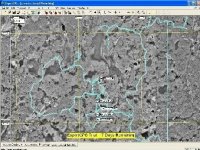
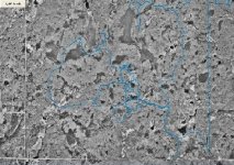
I'm not sure is this will help your situation. I made this Trail Map using my Garmin GPS II+ (which is broken now) and Delorme 3D TopoQuads. In doing this project I ran into a few problems. Double tracking of the GPS and the dead reckoning line (from shutting reciever off and turning on in a different location). The other was drawing on the map. The delorme 3d topo was not user freindly but I managed to get it to work. The only things that I could load into my GPS (via delorme) was waypoints and routes. When doing other work (scouting boundary, possible new trail routes, etc.) I would make a route out of a boundary line. Load the route into my GPS, activate the route and use my map screen to see where I was. Then when I got back I would up load the track to delorme and draw on my track route which followed the boundry. Sounds very confusing, is took me a long time to figure all the in and out of the delorme software, I still don't like it.

I have a new GPS now a Magellan Meridian Platinum. What I like about it the most is that it uses a media card (like a digi camera) so I can store smaller tracks and avoid double tracking and making the editing hopefully a lot easier? I just got my new GPS and haven't had time to really fool with it. Another feature that I like about the Meridi Plat is that once you upload topo data to the GPS you can look at you vertical profiles on past tracks or routes and projected routes and tracks right on your GPS.

Link to Megallan Meridian Platinum
 
   / GPS Discussion Group #18  
I was using the Delorme Earthmate attached to a palm V and their Solos software.
 
   / GPS Discussion Group #19  
So... The software you are looking for need to be for a PC not your Palm?

Is what I did on the trail map similar to what your trying to acomplish?
 
   / GPS Discussion Group #20  
I am trying this program ExpertGPS for a fee thirty day trial. Just downloaded it and have been fooling around with it. The editing seems very full in features. It can send routes to GPS as tracks. You may want to give it a try, the demo is free. Just make sure you pick the right map you want for the demo. They only allow one state map for the demo. Once you pay $60 you have unlimited maps of all 50 states. Plus it lets you do photo maps in addition to topo maps.

This software blows away my Delorme 3d topoquads!
 

Tractor & Equipment Auctions

2025 Kivel 48in Forks and Frame Skid Steer Attachment (A50322)
2025 Kivel 48in...
2022 ONYX RX34 FLOOR SWEEPER (A50458)
2022 ONYX RX34...
2017 Ford F-550 Ext. Cab Valve Maintenance Truck (A50323)
2017 Ford F-550...
2003 Ford F-650 Flatbed Truck, VIN # 3FDNW65243MB03484 (A48836)
2003 Ford F-650...
2017 Ford F-450 Crew Cab Mason Dump Truck (A50323)
2017 Ford F-450...
https://www.accessnewswire.com/newsroom/en/healthcare-and-pharmaceutical/nerve-alive-supplement-reviews-inspired-by-nervecalm-for-natural-nerv-1044754
https://www.accessn...
 
Top