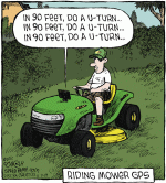
In my experience as a retired Navy Electronics Tech (Systems), particularly in Mine Warfare, a straight-up GPS System is accurate to placing 'you' within a few yards of where you actually 'are'. Which is fine for general navigation, including land vehicles which are controlled/steered by a human operator.
To truly narrow your position down to feet, or even inches, requires a "differential" reference (an accurately surveyed, geographical point - with a dedicated reference point transmitter of that point) to that vehicle's GPS System in order to do this. This is referred to as DGPS.
Add on top of this that, in order for autosteer to properly navigate your vehicle, the field would have to be precisely surveyed, with all fencing and obstacles pinpointed.
It's 'do-able' but the cost is prohibitive.