Thoughts of a Land Surveyor.

   / Thoughts of a Land Surveyor.
  • Thread Starter
#41  
Surveyors say GIS stands for get it surveyed.
 
   / Thoughts of a Land Surveyor. #42  
I'm familiar with a parcel of land along a river that was subdivided into about a dozen lots all about the same size (average 100' wide and 350' deep)...I was here when the original survey laying out the lots was done and know exactly where the original corner pins are...

On a few occasions where one or more of the lots changed hands and a new survey was done...the new surveys never once agreed with where the original pins should be...some would be different by nearly 3'...
It happens. The subdivision where our family camp is was done in the 1950's. Somewhere around 1975 it was determined that the first pin was set about 17 feet to far to the north, thereby making every lot corner in the 25+ lot subdivision about 17 feet to the north. In another case a former employer sold the corner lot of a much larger parcel which abutted two roads. When it was carved out the surveyor used the wrong road r/w width so had to go back and fix it. The problem was that on his second attempt he added 17 feet as he left the road; then tacked it on again at the far end, so that the corner was that much too long. Since he never closed his survey I picked up on it when connecting the two back pins with a hand compass, but at the point they decided not to pursue it.
 
   / Thoughts of a Land Surveyor. #43  
<snip>
When a person buys a house or piece of property, it is most likely the largest investment they will make in their life. Why not get it surveyed BEFORE you buy it? <snip>
It's a good idea IN THEORY. But your out the money if the purchase falls through.

Before we bought our current Mississippi "retirement tree farm" we were hot and heavy on another parcel, closer to town and smaller but IDEAL.

The owners we eventually found out were just ripping of buyers. They mandated it had to be closed on in 4 weeks. "They" were two sisters that lived in different towns. After we started the process they would only deal via mail, no faxes. And they took their sweet time to return documents "oh, the weather was bad", "I had to go to the doctors", just a ton of excuses for not getting signed paperwork back and forth. At the end of 4 weeks we asked for an extension. They said no, start over.
Luckily we had only put down a small deposit and we told them to file it where the sun don't shine. They asked for a copy of the survey we had done, but we had not recorded it yet and they did not get it. But we were out about a grand for the survey.

The next place was being sold as house w/2.5 acre, and land 70 acres, survey turned up house w/ 3.5 acres and something like 67 for the rest, but all is good and we bought it.

I spent my entire working career with the Army in what is now the Army Geospatial Center and worked closely with a lot of good surveyors.

But it was drilled home to me early in my career when my Father was selling the house I grew up in and the 20 acres more or less that went with it. He had bought the 20 acres more or less about 1963 and he, my Grandfather, and I built a duplex on it. (I miss that, it was a slice of paradise. I could walk out the basement door and catch 3lb trout for breakfast, lunch or dinner)

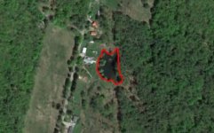
pond-essex.jpg
I insisted he get a survey, because I had studied the aerial photos and thought the boundaries I grew up on were bigger. It ended up that the 20 acres more or less had grown to 30 acres by 1978!
 
   / Thoughts of a Land Surveyor.
  • Thread Starter
#44  
As a rule but it is not set in stone and can be regional, the seller pays for the survey.
 
   / Thoughts of a Land Surveyor. #45  
Dads farm is 1/4 of a section, plus another 1/16 section. A section is a sq mile by definition, but in reality they aren't. Even the section corners are not well defined. The GIS maps are way off.
 
   / Thoughts of a Land Surveyor. #46  
This is a parcel which was selling in Plano, TX a few years ago...

Every little bit counts... BTW... that is 10x10' shy of 7ac.

Texas acreage pic.JPG
 
   / Thoughts of a Land Surveyor. #47  
I have a survey question. I bought a piece of land in 2006, the entire legal description of the property in the deed reads as follows (identifying information redacted):

That certain parcel of land, with the buildings and improvements thereon, situated in the Town of _____ , County of ________, State of Rhode Island, bounded and described as follows:

NORTHERLY partly on a highway known as _____ Road, partly by land now or formerly of [Person 1] and partly by land now or formerly of [Person 2].

EASTERLY on ____ Brook.

SOUTHERLY by land now or formerly of [Person 3].

WESTERLY partly by said [Person 3] land and partly by land now or formerly of [Person 4].

Containing approximately __ acres. Be all said measurements more or less, or however otherwise the same may be bounded or described.

Looking at online genealogy records, I've been able to establish that:
Person 1 lived 1848-1928.

Person 3 lived 1830-1920.

Person 4 lived 1829-1908.

I believe this description was recorded around 1875 when the property was mortgaged for the first time. The property was acquired in 1683 by a family that owned it until 1950, passing only through inheritance.

Is there any point to a survey with a description this vague? Property lines are marked by stone walls, I have aerial photos from the 1930's showing the location of the stone walls, they haven't moved.
 
   / Thoughts of a Land Surveyor. #48  
Surveyors say GIS stands for get it surveyed.

GIS data bases are only as good as the data that they are built with. In many cases boundary and parcel information is taken from the county assessor`s tax maps. If it is continually updated with data from recorded surveys it can be fairly good in those areas that the survey data covers.
I remember a lot of debates between the GIS managers and the survey and mapping folks on how accurate the data should be. The GIS folks for the most part were not very interested in spot on accuracy, they were more interested in getting the most coverage for the least cost.
In the early days many paper plat maps were hand digitized to bring the data into the digital realm. Consider that a line on a 1:24000 scale map is about 1/50 of an inch wide and 1"=2000' the error in measurment is up to 40` - assuming the paper map was correct to start with!
 
   / Thoughts of a Land Surveyor.
  • Thread Starter
#49  
Quicksand, your out east where the ground was never split up into sections of ground that are a mile square. The east part of US is like your deed, metes and bounds. In your case it has calls for adjoiners. I can not tell you if you need a survey or not. You think you know where the boundaries but a new survey may prove you wrong or might prove you correct.
 
   / Thoughts of a Land Surveyor. #50  
I have a survey question. I bought a piece of land in 2006, the entire legal description of the property in the deed reads as follows (identifying information redacted):


Looking at online genealogy records, I've been able to establish that:
Person 1 lived 1848-1928.

Person 3 lived 1830-1920.

Person 4 lived 1829-1908.

I believe this description was recorded around 1875 when the property was mortgaged for the first time. The property was acquired in 1683 by a family that owned it until 1950, passing only through inheritance.

Is there any point to a survey with a description this vague? Property lines are marked by stone walls, I have aerial photos from the 1930's showing the location of the stone walls, they haven't moved.
That's where a surveyor shows that his career is an art as well as a science. My deed is very similar. If the lines weren't well defined by fences, lines of occupation as well capped surveyor's pins on one side and partway up the back- or if I was going to be doing anything near them- I would have had it surveyed long ago.
On the sideline which the abutter had surveyed there is a rock wall ; yet he opted to go with a wire fence instead which was straighter. Unfortunately he died in a car wreck years so so I am unable to talk to him.
 
 
Top