RalphVa
Super Member
- Joined
- Dec 19, 2003
- Messages
- 7,902
- Location
- Charlottesville, VA, USA
- Tractor
- JD 2025R, previously Gravely 5650 & JD 4010 & JD 1025R
I'd been accessing Google Earth from one of my old HDs using a HD/USB adaptor. Well, my wife's old HD apparently ruined it or maybe my old HD with its bad sectors made some more, etc. and ruined it. Can no longer read HDs on it.
Found Google Earth online. Just Google it and you'll find (below the ads) a URL for it. So, I went exploring. One thing was to explore places where we've lived.
They're attached. I've never figured out how to put them right here in the message.
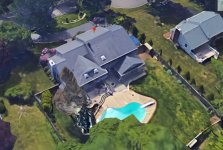
We lived at the place in NJ for 20 years (I was only there less than 1/2 the time, what with our travelling on business, etc.). The house and swimming pool have not changed except for that butt out on the right of the house in the rear, but there've been extensive changes to the property, including the driveway. Driveway used to be very steep right straight down in front of the garage on the right end of the house. We used to sled down that driveway, making a severe right to avoid the neighbor's mailbox across the street.
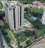
The place in Singapore is called Beverly Hill. It is a condo tower. Our condo there was 5500 sq ft, bigger than this house in Va and the same size as the house in Baton Rouge parish.
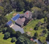
The other pic is of our place on 8.5 acres here in Va just west of Charlottesville. Our property goes down to Ivy Creek. We're right near the Barracks POW camp where the hessian soldiers were kept in the Revolutionary War.
I could not get a good pic of the house in BR parish because of all the trees on that part of South Fulwar Skipwith (name of a southern general).
Ralph


