ShantyBranch
Bronze Member
This looks pretty cool.
http://www.fortunecity.com/marina/nelson/479/
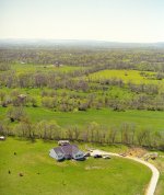
I have been wanting aerial pics of my property. I got some from a plane fly over - but they were just too far up to get detail I wanted.
Anybody have any experience with this birdseye view of things??
http://www.fortunecity.com/marina/nelson/479/
http://www.fortunecity.com/marina/nelson/479/
I have been wanting aerial pics of my property. I got some from a plane fly over - but they were just too far up to get detail I wanted.
Anybody have any experience with this birdseye view of things??
http://www.fortunecity.com/marina/nelson/479/